Malacca Maps and Orientation
(Malacca / Melaka City, Malaysia)
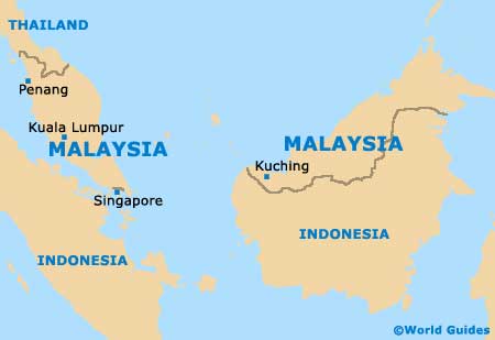
Malacca lies on the south-west coast of Peninsula Malaysia, overlooking the Straits of Malacca / Melaka. The city lies approximately 144 km / 89 miles to the south-east of the capital city, Kuala Lumpur, on a heading for Johor Bahru and Singapore, in a region of flat land.
Although a sizeable city, Malacca is only a few kilometres across and the main attractions can be comfortably covered on foot or trishaw (a type of cycle rickshaw). The city is made up of three main areas - the historic core, where the colonial buildings and Chinatown reside, nearby Taman Melaka Raya - a reclaimed coastal area, and the administrative part farther north.
Maps and Orientation of the City
Most streets are winding and go this way and that, while the nearest highway is several kilometres away to the north. The main bus station, named Malacca Sentral, is to be found some 5 km / 3 miles to the north of Chinatown.
Maps of Malacca are best purchased before you travel, although you can also pick one up from the Tourism Malaysia office at the Menara Taming Sari building, on the riverbanks of the Sungai Melaka.
- Alor Gajah - 24 km / 15 miles (30 minutes, north)
- Ayer Keroh - 12 km / 8 miles (20 minutes, north-east)
- Bukit China - 2 km / 1 mile (five minutes, east)
- Gunung Ledang Recreational Forest - 65 km / 40 miles (one hour and 15 minutes, east)
- Johor Bahru - 219 km / 136 miles (two hours and 50 minutes, south-east)
- Kuala Lumpur - 144 km / 89 miles (two hours, north-west)
- Mersing - 240 km / 150 miles (three hours and 20 minutes, east)
- Muar - 48 km / 30 miles (one hour, south-east)
- Port Dickson - 80 km / 50 miles (one hour and 20 minutes, north-west)
- Seremban - 81 km / 51 miles (one hour and 25 minutes, north-west)
- Singapore - 254 km / 158 miles (three hours and 30 minutes, south-east)
Map of Malaysia
Map of Malacca
